Primary Equipment
The aircraft behind every Skysight survey. Six sensing systems working together, each capturing a different kind of information about the same site on a single flight — which is what makes single-visit data capture possible across a full property.
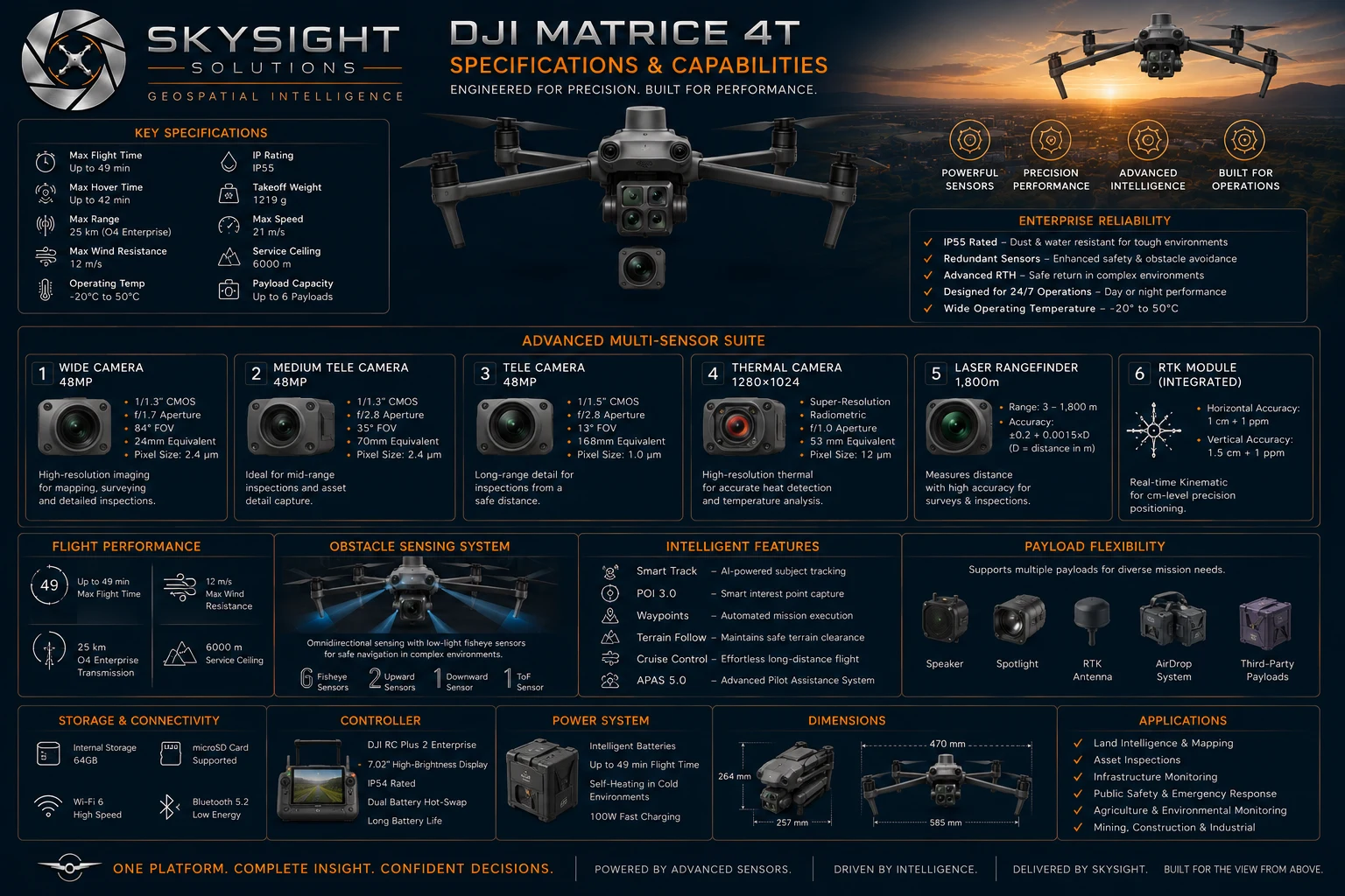 View full size
Detailed specification sheet — tap or click to open it full size for reading.
Audio Overview
Most people picture a drone as a camera that flies. The Matrice 4T is closer to a survey instrument — six sensing systems working together, each capturing a different kind of information about the same site on a single flight.
The four-camera array covers wide, medium telephoto, telephoto and thermal. The wide 48 MP sensor does the mapping work. The telephoto resolves fine detail — fasteners, cracks, serial numbers — from a safe standoff distance. The thermal camera reads emitted heat radiometrically, revealing moisture, electrical faults and living animals that no optical camera can see.
Alongside them sit an integrated RTK module delivering centimetre-level positioning and a laser rangefinder accurate to 1 800 m. Together these are what allow the resulting maps and models to be measured against, rather than simply looked at.
In practical terms: up to 49 minutes in the air, omnidirectional obstacle sensing, IP55 weather resistance and an operating range of −20 °C to 50 °C. That is what makes single-visit data capture possible across a full property, in one session, in Southern African conditions.
The aircraft is an instrument, not the product. What matters is the information it brings back — measurable maps, terrain models, thermal findings and reports you can act on.
Want to know what this could tell you about your own property or assets?
Book a Consult