Infographic · July 2026
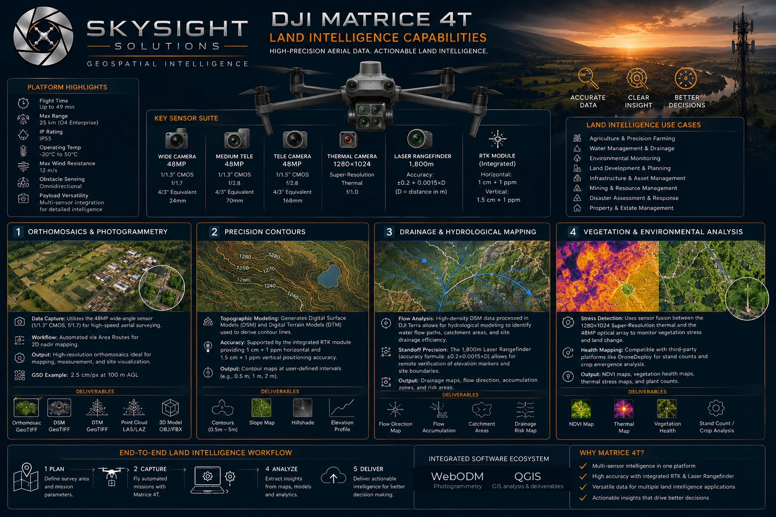
Orthomosaics, precision contours, drainage and hydrological mapping, and vegetation analysis — the four pillars of a land survey, with the deliverables each one produces.
 View full size
Detailed infographic — tap or click the image to open it full size for reading.
A land intelligence survey answers four separate questions, and it answers them all from the same flight.
What is there, and where exactly? That is the orthomosaic — a distortion-corrected aerial map you can measure distance and area on, typically at around 2.5 cm per pixel.
How does the land sit? Digital surface and terrain models produce contours at whatever interval you need, backed by RTK positioning accurate to roughly a centimetre.
Where does water go? Flow paths, catchment areas and accumulation zones — the information that determines dam siting, erosion risk and where a building should not go.
What is growing, and how healthy is it? Sensor fusion between the thermal and 48 MP optical arrays produces vegetation health mapping, stand counts and land-change comparison over time.
Every one of those outputs is delivered in GIS-ready formats, so the data continues to be useful long after the report has been read.
Want this applied to your own property, site or asset?
Book a Consult