Infographic · July 2026
Why an orthomosaic is not simply a large aerial photograph, how thousands of overlapping images become one map you can measure on, and what accuracy you can reasonably expect.
 View full size
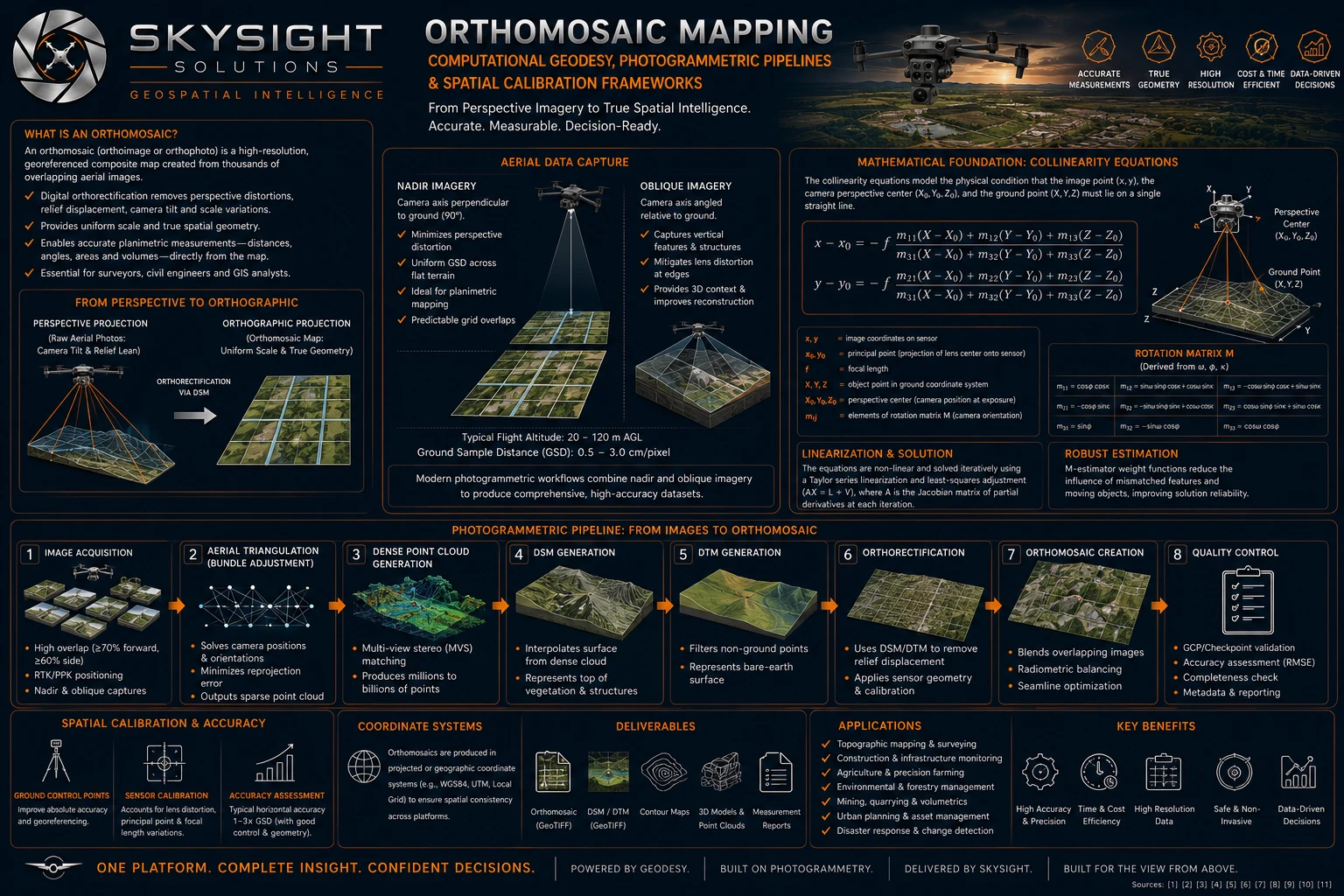
Detailed infographic — tap or click the image to open it full size for reading.
Take a photograph from an aircraft and something counts against you that is easy to miss: only the point directly beneath the camera is seen from straight above. Everything else is viewed at an angle. Buildings lean outwards, hillsides stretch or compress, and the scale changes across the frame. It looks like a map, but you cannot measure anything on it and trust the answer.
An orthomosaic fixes that. Thousands of overlapping photographs are combined, and every one is mathematically corrected so that the whole image reads as though it were taken from directly overhead at every point. The result has uniform scale and true geometry — distances, areas and boundaries can be measured straight off it.
Getting there is an eight-stage process: capture with heavy overlap, work out exactly where the camera was for every shot, build a dense three-dimensional point cloud, derive surface and terrain models from it, use those models to remove the distortion, blend the corrected images together, and check the result against known control points.
What you can expect in practice: a ground sample distance of roughly 0.5 to 3 cm per pixel depending on flight altitude, and horizontal accuracy in the order of one to three times that figure where ground control and survey geometry are good.
The output is a GeoTIFF — a map file carrying its own coordinate information, which opens directly in QGIS or any GIS package. It is not a picture of your property. It is a measurement instrument you keep.
Want this applied to your own property, site or asset?
Book a Consult