Infographic · July 2026
How individual tree detection works, where it performs best, and what an owner does with a mapped point for every tree carrying its height and crown size.
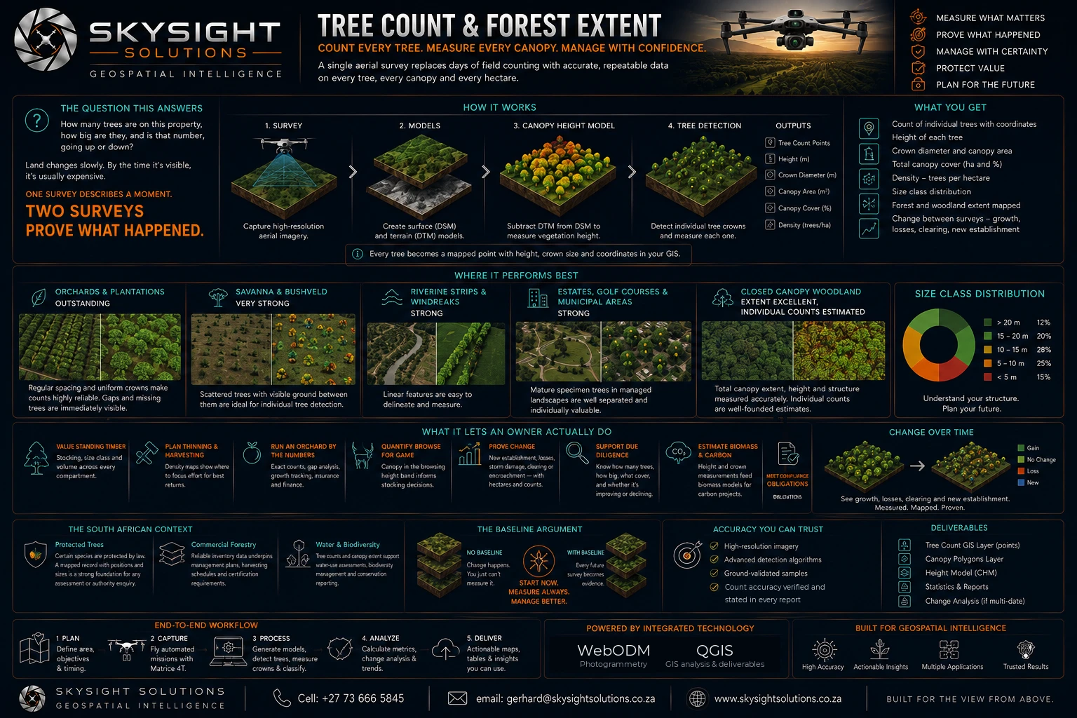 View full size
Detailed infographic — tap or click the image to open it full size for reading.
How many trees are on this property, how big are they, and is that number going up or down? A single aerial survey replaces days of field counting with data on every tree, every canopy and every hectare.
The process runs in four stages: capture high-resolution imagery, build surface and terrain models, subtract one from the other to get a canopy height model, then detect individual crowns within it and measure each one. Every tree becomes a mapped point carrying its height, crown diameter and coordinates.
Where it performs best: orchards and plantations are outstanding, because regular spacing and uniform crowns make counts highly reliable and missing trees immediately visible. Savanna and bushveld are very strong, since scattered trees with visible ground between them are ideal for individual detection. Riverine strips and windbreaks are easy to delineate. Estates and municipal grounds, where mature specimen trees are well separated and individually valuable, make an inventory well worth having.
Under closed canopy the survey measures total extent, height and structure accurately, while individual stem counts become well-founded estimates — which for extent, biomass and change over time is entirely sufficient.
What an owner does with it: value standing timber by stocking and size class, direct thinning to the compartments that need it, run an orchard by exact block counts for yield and insurance, quantify browse in the game-relevant height band, and prove change between surveys with hectares and counts attached.
And the South African dimension — certain tree species are protected by law, so a mapped, dated record with positions and sizes is a strong foundation for any assessment or authority enquiry.
Want this applied to your own property, site or asset?
Book a Consult